Find the Centro, plan the best walking routes, and choose the right map for driving, parking and day trips—this page is the map-focused companion to our full travel guide.
See the Complete Travel Guide for broader planning (accommodation, festivals and logistics); use this page when you need maps, routes and navigation details first.
Use a printable Centro map for walking; an interactive digital map for errands and day trips; a road/route map for driving outside town. For printable maps and an annotated Centro map, see our local map guide linked below.
Planning Checklist: What Map You Actually Need
- Walking Centro & photo spots: printable street map with Parroquia landmark and pedestrian routes.
- Short day trips (Guanajuato, hot springs): regional road map + route planner.
- Driving & parking: road map + local parking tips (see parking section).
- Accessibility needs: pick maps that show slopes, stair locations and public-transport stops.
Which Map To Use — One Clear Table
| Use case | Best map & quick tips |
|---|---|
| Walking Centro / photos | Printable Centro map (annotated) — highlights: Parroquia, Jardín, stair streets to viewpoints; bring a paper copy for narrow alleys. |
| Short day trips | Driving route map + Google/Apple maps on phone for live directions; check toll vs free roads before you go. |
| Driving & parking | Road map + local parking map (Centro has restricted zones); park at garages outside Jardín and walk in. |
| Accessibility & public transport | Choose maps that mark ramps and public-transport stops; call hotels for drop-off details on steep streets. |
Core How-To: Centro Walking Routes And Read-This-Map Tips
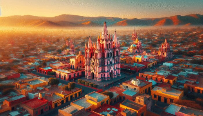
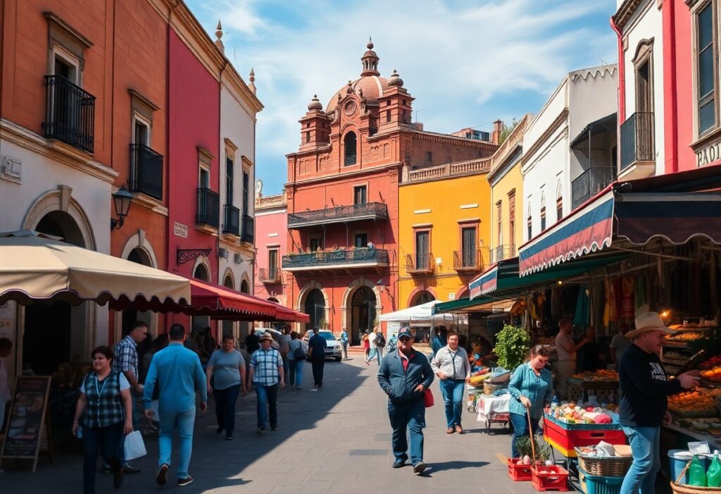
San Miguel’s Centro is compact but hilly and full of narrow cobbled streets. Use an annotated Centro map when you plan photo stops, markets and the Parroquia circuit. Short, practical routes:
- Classic Loop (60 — 90 Minutes) Jardín → Parroquia → Calle Recreo → Mercado de Artesanías → return via Calle Umarán.
- Viewpoint Route (Sunrise/Sunset) Start at Parroquia, climb to Mirador at Aldama / Insurgentes for panoramic shots.
- Markets & Food Walk Mercado de Artesanías → Fabrica La Aurora (art park) — use a map to time visits around opening hours.
For annotated Centro maps and printable versions, follow the local map guide here: Printable & annotated maps.
Driving, Parking And Accessibility — Practical Tips
- Park Outside The Jardín Centro parking is limited and many streets are off-limits to non-residents—use public garages and walk in.
- Narrow Streets & GPS Expect GPS to route you to pedestrian-only lanes; keep a paper map or offline map tile as backup.
- Accessibility Many central streets are steep or cobbled—ask accommodations for exact drop-off points and check local maps for ramped streets.
Getting There, Timing And Booking Windows
Timing affects which maps and routes you should use:
- High Season (Nov — Mar, Especially Holidays) Center gets crowded—use walking maps and reserve parking/garage space in advance.
- Low Season (Summer Rains) Fewer crowds but check road conditions for day trips; some rural roads are affected by heavy rain.
- Booking Window If you need parking or a guided walking tour, book 2–6 weeks ahead in high season; otherwise a week is usually fine.
For airport connections and transfer options, see our arrival guide: Airport & transport options.
Where This Page Fits And Where To Go Next
- Open the printable Centro map: Printable & annotated maps.
- If arriving by air, check transfer options and airports: Airport & arrival tips.
- Read the safety checklist before evening walks: Safety & walking advice.
Use the Complete Travel Guide for everything beyond maps—transport, where to stay, and multi-day itineraries.
Frequently Asked Questions
Is It Safe To Walk Around San Miguel At Night?
Centro is generally safe after dark in tourist areas, but take normal precautions: stick to well-lit streets, avoid empty alleys, and check the safety advice page before late walks.
Which Airport Should I Use?
Querétaro (QRO) and León (BJX) are common choices; Mexico City is also an option with longer transit time. See detailed airport options and transfer tips here.
When Is The Best Time To Visit?
High season is Nov–Mar for dry weather and festivals; shoulder months (Oct, Apr) balance good weather with fewer crowds—adjust map choices if visiting during major events.
See also: San Miguel travel map guide, Airport & transport, and safety tips.
Eliot Mercer is an insightful author and local enthusiast, specializing in the vibrant culture and scenic beauty of San Miguel de Allende. With a passion for storytelling, he explores the rich history, diverse arts, and unique lifestyle of this enchanting Mexican town, providing readers with a captivating lens through which to view the community. Through his engaging writing, Eliot invites others to discover the charm and allure of San Miguel de Allende, sharing his personal experiences and deep appreciation for the area’s traditions and modern dynamics.
It’s interesting how maps serve not just as guides but as storytelling devices that capture the essence of a place. In San Miguel de Allende, for instance, navigating through its vibrant streets and historical buildings becomes more meaningful when you understand the context behind each landmark. I remember getting lost during my first visit, only to stumble upon a hidden art gallery that wasn’t marked on any tourist map. It sparked my appreciation for exploring without strict guidelines and trusting the serendipity of those moments.
Ah, maps—the unsung heroes of our travels. It’s like having a GPS but without the snarky tone when you miss a turn! Your guide is a fantastic reminder of how these colorful illustrations bring our wandering minds back to reality (and to the right café!).
The exploration of maps as a vital tool for navigating unfamiliar territories is so timely and necessary, especially in a world where travel is sometimes both an adventure and a challenge. Your discussion highlights a fundamental aspect of maps: they aren’t just geographical representations, but also narratives of our interactions with spaces.
Your exploration of the role of maps in enhancing our understanding of geographical layouts strikes a chord with me, especially in the context of a vibrant place like San Miguel de Allende. It’s fascinating how maps not only illustrate locations but also serve as a narrative tool, conveying the historical and cultural significance of areas.
You’ve brought up some fascinating points about the multifaceted role of maps in our understanding of geography. I believe that, beyond just navigation, maps also serve as cultural artifacts that reflect the values and priorities of the societies that create them. For instance, a map that emphasizes public parks or community centers can offer insights into a community’s commitment to public space and well-being.
You’ve highlighted such an interesting aspect of maps that often gets overlooked. They definitely can tell us a lot about cultural priorities. For instance, consider historical maps that show trade routes or military strategies; they reveal not just geography but also what societies valued at the time—whether it was commerce, conquest, or exploration.
You’ve highlighted such an interesting aspect of maps that often gets overlooked. It’s fascinating how something that seems so straightforward on the surface can hold so much depth about societal values and priorities. The way historical maps chart trade routes or military strategies indeed gives us a glimpse into what those societies considered essential.
As I navigated the winding streets of San Miguel de Allende last summer, I found myself pondering the universal truth that maps are, in a strange way, like the quirky friends we all have. You know, the ones who guide you through the maze of life’s adventures, occasionally leading you astray but ultimately sharing a treasure trove of experiences along the way. There I was, clutching a colorful map with the excitement of embarking on a treasure hunt, only to discover that the “shortest route” to the nearest taco stand often involved a 20-minute detour past some oddly charming art galleries and a very persuasive street performer who’s convinced he’s the reincarnation of Frida Kahlo.
I love the way you’ve captured the essence of exploring new places through the lens of maps. It’s true—maps can turn a simple stroll into an adventure. Your experience in San Miguel de Allende really resonates. Those winding streets, with their vibrant colors and surprises around every corner, can be like a beautifully crafted story where you’re both the main character and the reader.
Your reflection on maps and friendships really resonates with me. There’s something so poetic about how both guide us, offering unexpected detours that often become the highlights of our journeys. It reminds me of a recent experience when I visited a new city. I was determined to stick to my phone’s GPS, thinking it would save me time. But the few moments I chose to wander off that path—driven by the vibrant street art or the inviting sounds of a local band—led me to some of the best coffee shops and art galleries that weren’t on any tourist itinerary.
Your exploration of maps as essential tools for navigation and understanding resonates deeply, especially in the context of a culturally rich and diverse place like San Miguel de Allende. It’s fascinating to consider how maps not only represent physical landscapes but also shape our perceptions of them. While your post highlights the fundamentals of mapping, it invites a broader consideration of how the digital age has transformed our relationship with physical maps.
The intricate relationship between maps and our understanding of geography cannot be overstated, especially in a location as rich in culture and history as San Miguel de Allende. Your guide underscores how maps act not just as navigational tools but as storytelling devices that convey the essence of a place.
You bring up a crucial point about the role maps play beyond mere navigation. In places like San Miguel de Allende, a map can reveal layers of meaning—its vibrant markets, historic architecture, and winding streets all tell stories that connect to the culture and traditions of the area.
“Explore our detailed guide to maps in San Miguel de Allende and uncover the stories they tell!”
https://fallinginlovewithsanmiguel.com/transport
Your exploration of maps as essential navigational tools truly resonates with me. In our increasingly digital world, it’s easy to overlook the art and science behind traditional map-making. I often find that using a physical map not only sharpens my sense of direction but also deepens my connection to the places I visit. For example, I’ve unearthed hidden gems in cities simply by following a winding path on a map, discovering local cafés or parks that wouldn’t have shown up on a GPS app.
It’s refreshing to hear your thoughts on the value of traditional maps in today’s fast-paced digital landscape. There’s something almost poetic about unfurling a physical map, isn’t there? The way it encourages us to slow down and really observe our surroundings can lead to unexpected adventures.
I’m glad to hear that you appreciate the art of traditional map-making! If you’re interested in exploring more about the beauty of maps and perhaps discovering new routes, check out this link for some great resources and unique map collections.
https://fallinginlovewithsanmiguel.com/food-and-drink
Your exploration of the essential role maps play in navigating both geographical and cultural landscapes resonates deeply with me. Maps are more than just tools; they encapsulate stories and histories of the places we explore. For instance, when I visited San Miguel de Allende, I found that having a well-detailed map not only guided my steps through its winding streets but also enriched my understanding of local history and architecture, especially in neighborhoods that showcase distinct colonial features.
It’s great to hear how much your experience in San Miguel de Allende was enriched by a good map. That city is a real treasure, isn’t it? The way the streets twist and turn, with all that colonial architecture around you, really makes each corner feel like a new discovery.
I really appreciate how your post highlights the essential role of maps in our understanding of spatial relationships, particularly in a place as captivating as San Miguel de Allende. Maps are so much more than just tools for navigation; they encapsulate the stories of places, connecting us with their histories and cultures.
Ah, maps! The unsung heroes of navigation and interpersonal relationship rescue missions. I can hardly think of a better way to start a conversation than with the topic of maps, especially in a place as enchanting as San Miguel de Allende. It’s like a puzzle waiting to be solved, isn’t it?
I love how you break down the essentials of maps—it’s like giving a GPS a personality! You know, every time I pull out a map, it’s like I’ve summoned a treasure map to adventure, minus the pirate hats (unless, of course, you’re into that).