
San Miguel de Allende sits at roughly 1,900 meters (≈6,235 feet) above sea level — a moderate altitude that is comfortable for most visitors, though people with certain health conditions or planned strenuous activity should take basic precautions.
- Who May Feel It older adults, infants, people with cardiovascular or pulmonary conditions, and anyone planning heavy hiking or cycling.
- Top Precautions hydrate, avoid heavy exertion on day 1, pack warm layers for cool nights, and bring any needed prescriptions.
- When To Worry persistent headache, dizziness, severe shortness of breath — seek local medical care.
For a short practical list of step-by-step visitor tips, see our detailed visitor altitude tips.
At A Glance: Numbers And Quick Effects
What The Altitude Means In Plain Terms
At ~1,900 m you’ll notice slightly thinner air: aerobic activities feel a bit harder for the first day or two, nights are cooler than lowland Mexico, and mornings can be crisp. Serious altitude sickness is uncommon at this elevation but not impossible for vulnerable travelers.
Are You At Risk? — Simple Decision Table
| Ask Are you older than 65, pregnant, have heart/lung disease, or traveling with infants? |
If yes → Take Precautions consult your doctor, move slowly first day, carry necessary meds. If no → Low Risk rest on arrival and enjoy light activity. |
| Ask Do you plan high-altitude hiking/cycling or rapid ascents above 2,500 m? |
If yes → Prepare schedule an acclimation day, hydrate, and consider a slower ascent profile. |
Why Elevation Matters In San Miguel De Allende
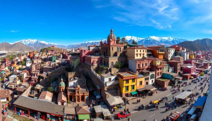
Elevation shapes daily weather and seasons here: daytime can be warm in sun, while nights are noticeably cooler — often 10–15°C (18–27°F) swing between day and night in shoulder seasons. The thinner air also means sunburn risk is higher; use sunscreen and a hat.
Weather And Seasons — Short Guidance
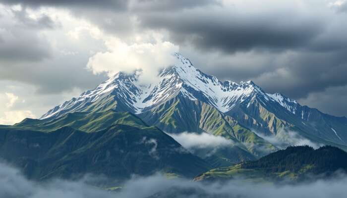
The dry season (November–April) brings crisp mornings and clear skies; the rainy season (June–September) yields warm afternoons and afternoon thunderstorms. If you want fewer crowds and comfortable days, the best compromise months are late October–November and March–April.
How To Prepare: Practical Checklist
- First 24 Hours hydrate, avoid alcohol, keep activity light.
- Packing light layers for daytime, warm jacket for nights, sun protection, and comfortable shoes for cobbled streets.
- Medical bring prescriptions, and if you have heart/lung issues consult your doctor before travel.
- Food & Water tap water safety varies — for tips, see drinking water safety and our travel essentials.
If you plan sunrise photography or rooftop views, bring a warm layer — see our guide to best viewing spots for sunrise.
When To Go And When To Book
Timing affects temperature swings and crowds more than altitude. Peak festival seasons (e.g., major cultural events) fill hotels early — book 2–4 months ahead for high-season dates; otherwise a 4–6 week window usually secures good options. For event-specific planning, check current listings: see what’s on.
| Elevation | What To Expect |
| ~1,900 m (San Miguel) | ~5–10% less oxygen than sea level; cooler nights; modest effect on exertion for most visitors. |
Where To Read Next And A Quick Decision
If altitude is your main concern, our focused altitude visitor tips and the broader complete travel guide will help you plan accommodations and activities. For event-related dates and crowd planning, see upcoming events.
Major festivals and public events change lodging availability. If your dates overlap a festival, book earlier; otherwise a normal booking window applies.
Frequently Asked Questions
Is San Miguel De Allende High Altitude?
It is a moderate-altitude city at ~1,900 m (6,235 ft). That is higher than sea-level destinations but below elevations where severe altitude sickness is common.
Will I Get Altitude Sickness?
Most visitors will not, but some experience mild symptoms (headache, mild breathlessness). Rest, hydrate, and limit heavy activity on day one to reduce risk.
Does It Get Cold?
Yes — nights can be cool year-round, and shoulder seasons bring the largest day/night swings. Pack a warm layer for evenings.
If you need tailored advice for a medical condition or vigorous mountain activities, consult a healthcare professional before travel and read our detailed altitude visitor tips.
Jasper Lennox is an insightful author and dedicated chronicler of the vibrant culture and history of San Miguel de Allende. With a passion for exploring its rich tapestry of art, architecture, and community, he crafts engaging narratives that showcase the charm and allure of this enchanting Mexican town. Through his writing, Jasper invites readers to discover the unique stories and experiences that make San Miguel a beloved destination for travelers and locals alike.
I appreciate your insights on the altitude of San Miguel de Allende and the precautions for visitors. Having recently traveled to a similar elevation, I learned firsthand how even moderate altitude can catch you off guard. As someone with a history of migraines, I found that staying well-hydrated and pacing myself on the first day made all the difference. It’s interesting how a beautiful destination can also require a bit of foresight regarding health.
The insights you’ve shared about San Miguel de Allende’s altitude truly resonate with my own experiences! Having traveled to various destinations at high elevations, it’s fascinating to see how different bodies respond to the altitude and how compliance with simple precautions can significantly enhance the experience.
Your insights about the elevation of San Miguel de Allende and the necessary precautions resonate deeply with the experiences many travelers face as they deal with altitude. It’s interesting how something as simple as hydration can significantly impact one’s ability to enjoy a destination. I remember experiencing mild altitude sickness on my first day in a high-altitude city, and it certainly put a damper on my plans until I adjusted.
Ah, the joys of visiting a high-altitude paradise like San Miguel de Allende! I must say, I find your point about the elevation being “moderate” both reassuring and slightly concerning at the same time. As someone who once climbed half a mountain only to have it insist on reaching a height that had my knees shaking and my breath leaving me in a comedic race against time, I appreciate the need for caution.
It’s great to hear you’ve experienced the challenge that altitude can bring. San Miguel de Allende does sit at about 6,500 feet, which, in the grand scheme of high-altitude locations, is on the milder side. But “mild” doesn’t always translate to a walk in the park for everyone—your story about climbing a mountain resonates on a personal level.
This is such an insightful overview regarding the altitude of San Miguel de Allende and its potential effects on visitors. Having traveled to various high-altitude destinations myself, I’ve experienced firsthand how elevation can impact one’s body, particularly for those unaccustomed to such heights. It’s interesting to see the balance you’ve struck here between fostering excitement for this beautiful destination and acknowledging the necessary precautions.
It’s fascinating to read about San Miguel de Allende and how its altitude can impact visitors. I remember my first trip to a high-altitude destination—took me a couple of days to adjust, and honestly, I didn’t expect it to hit me as hard as it did. The headaches and breathlessness can really sneak up on you! I had to learn the hard way about staying hydrated and pacing myself.
I love how you highlighted the importance of understanding altitude when visiting San Miguel de Allende! It’s fascinating how our bodies react differently at higher elevations. I remember my first experience in a city at this altitude; I underestimated the effect and felt a bit dizzy — definitely learned the hard way to hydrate early!
It’s interesting how elevation affects our experience when traveling, especially in a place as vibrant as San Miguel de Allende. I’ve been there during the cooler months, and I remember having to adjust to the altitude, particularly on hikes outside the city. Hydration became my best friend!
This post highlights several important considerations for travelers heading to San Miguel de Allende, particularly around acclimatizing to its elevation. The moderate altitude, while comfortable for many, certainly calls for awareness, especially for those who may not be accustomed to it. I find your point about the different groups who may experience altitude sensitivity particularly relevant. For instance, older adults and individuals with pre-existing health conditions should certainly be cautious. I recall a trip to a high-altitude destination where a close friend, who has mild asthma, underestimated the effects. Their experience underscored how crucial it is to prioritize safety and listen to one’s body.
I appreciate the insights in your post about San Miguel de Allende and its elevation, which is crucial for visitors to consider. As someone who has experienced both the beauties and challenges of high-altitude locations, I can relate closely to your points on health precautions.